Category:Gasterntal
Jump to navigation
Jump to search
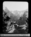
Deutsch: Das de:Gasterntal ist der oberste Teil des Kandertals in den Berner Alpen in der Schweiz.
English: Gasterental ist the name of the upmost valley of the Kander river in the Bernese Alps in Switzerland.
valley | |||||
| Upload media | |||||
| Instance of | |||||
|---|---|---|---|---|---|
| Location | Bern, Switzerland | ||||
 | |||||
Subcategories
This category has the following 9 subcategories, out of 9 total.
A
- Aerial views of Gasterental (19 F)
B
- Balmhornhütte (5 F)
G
- Gasternbibel (9 F)
- Geltenbach (9 F)
H
- Hotel Waldhaus (Kandersteg) (25 F)
K
S
Media in category "Gasterntal"
The following 76 files are in this category, out of 76 total.
-
A Tramp Abroad 0378h.jpg 1,540 × 1,872; 1.21 MB
-
Auengebiet Gastereholz, Gasterntal, Kandersteg BE 20220712-jag9889.jpg 3,456 × 4,608; 8.66 MB
-
Balmhornhütte Lage.jpg 1,280 × 853; 680 KB
-
CH-NB Photoglob-Wehrli EAD-WEHR-20756-B.tiff 7,483 × 5,640, 2 pages; 80.56 MB
-
CH-NB Photoglob-Wehrli EAD-WEHR-32097-B.tiff 4,676 × 3,568; 15.94 MB
-
Die junge Kander im Gasterntal, Kandersteg BE 20220712-jag9889.jpg 4,608 × 3,456; 11.76 MB
-
ETH-BIB-Bietschhorn, Gasterental v. N. W. aus 4000 m-Inlandflüge-LBS MH01-000449.tif 6,668 × 4,480; 85.62 MB
-
ETH-BIB-Gasterntal bei der Einbruchstelle-Dia 247-00959.tif 3,614 × 2,776; 9.69 MB
-
ETH-BIB-Gasterntal vom Gemmiweg-Dia 247-00526.tif 2,947 × 3,472; 9.85 MB
-
ETH-BIB-Gasterntal, aufwärts-Dia 247-F-00669.tif 3,634 × 2,915; 10.23 MB
-
ETH-BIB-Gasterntal-Einbruch, geolog. Karte-Dia 247-Z-00031.tif 3,608 × 2,861; 29.69 MB
-
ETH-BIB-Gasterntalboden mit Tatlishornfalte-Dia 247-00956.tif 3,619 × 2,752; 9.6 MB
-
ETH-BIB-Gastnertal, Querschnitt-Dia 247-Z-00032.tif 3,632 × 2,848; 29.73 MB
-
ETH-BIB-Kander-Einbruch, Gasterntal-Dia 247-00957.tif 3,415 × 2,772; 9.15 MB
-
Feldweg-Brücke über die Kander, Gasterntal, Kandersteg BE 20220712-jag9889.jpg 4,608 × 3,456; 11.95 MB
-
Feldwegbrücke über die Kander, Gasterntal, Kandersteg BE 20220712-jag9889.jpg 4,608 × 3,456; 11.3 MB
-
Fels Gasterntal.jpg 1,472 × 981; 192 KB
-
Folding Gasteretal.jpg 4,720 × 2,018; 2.34 MB
-
Fussgänger-Steg über die Kander, Gasterntal, Kandersteg BE 20220712-jag9889.jpg 4,608 × 3,456; 13.25 MB
-
Gasterental.jpg 1,600 × 1,200; 415 KB
-
Gasteretal.jpg 2,048 × 1,536; 775 KB
-
Gasteretal1.jpg 1,200 × 900; 340 KB
-
Gasternholz Nord.JPG 5,184 × 3,888; 6.38 MB
-
Gasternholz Panorama.JPG 4,912 × 1,080; 2.42 MB
-
Gasternholz Süd.JPG 5,184 × 3,888; 6.24 MB
-
Gasternholz Tafel.JPG 3,888 × 5,184; 7.5 MB
-
Gasternholz.jpg 3,456 × 2,304; 4.51 MB
-
Gasterntal alt.JPG 2,375 × 1,587; 2.22 MB
-
Gasterntal Aug.17.JPG 4,032 × 3,024; 3.57 MB
-
Gasterntal Balmhornbach.jpg 3,456 × 2,592; 3.05 MB
-
Gasterntal Bauernhof.JPG 2,496 × 1,664; 2.7 MB
-
Gasterntal Ende.jpg 2,590 × 1,838; 1.61 MB
-
Gasterntal Gfelalp.jpg 1,200 × 1,600; 583 KB
-
Gasterntal Kander.JPG 3,264 × 2,448; 5.7 MB
-
Gasterntal Morgenstimmung.JPG 4,470 × 3,137; 2.92 MB
-
Gasterntal Regenbogen.JPG 4,032 × 3,024; 3.16 MB
-
Gasterntal Regenwetter.JPG 4,032 × 3,024; 3.01 MB
-
Gasterntal Seitenbach.JPG 5,184 × 3,888; 7.28 MB
-
Gasterntal Steine1.JPG 3,264 × 2,448; 5.41 MB
-
Gasterntal Steine2.JPG 3,264 × 2,448; 5.43 MB
-
Gasterntal Wald.JPG 3,011 × 2,162; 3.62 MB
-
Gasterntal Waldhaus.jpg 2,450 × 1,608; 1.32 MB
-
Gasterntal Wiesen.JPG 2,496 × 1,664; 2.03 MB
-
Gasterntal Zufahrt.jpg 2,448 × 1,836; 219 KB
-
Gasterntal.jpg 1,024 × 768; 480 KB
-
Gasterntal01.jpg 1,600 × 1,200; 651 KB
-
Gasterntal02.jpg 1,600 × 1,200; 639 KB
-
Gasterntal03.jpg 1,600 × 1,200; 628 KB
-
Gasterntal04.jpg 1,200 × 1,600; 578 KB
-
Gasterntal05.jpg 1,600 × 1,200; 650 KB
-
Gasterntal1.JPG 3,264 × 2,448; 4.41 MB
-
Gasterntal2.jpg 1,024 × 817; 151 KB
-
Gasterntal3.JPG 3,264 × 2,448; 5.23 MB
-
Gasternthal, Bernese Oberland, Switzerland-LCCN2001701281.jpg 3,664 × 2,767; 2.87 MB
-
Gemmi, Gasthernthal, Bernese Oberland, Switzerland-LCCN2001701148.jpg 3,672 × 2,718; 3.35 MB
-
Jegertosse Fisistock.jpg 10,456 × 3,628; 14.98 MB
-
Kander Gasterntal.jpg 2,048 × 1,536; 524 KB
-
Kander Selden.JPG 4,032 × 3,024; 3.79 MB
-
Kandersteg-Gasterntal.jpg 800 × 1,200; 1.12 MB
-
Kiesschütte.JPG 5,184 × 3,888; 7.41 MB
-
Morgegab-Brücke über die Kander, Gasterntal, Kandersteg BE 20220712-jag9889.jpg 4,608 × 3,456; 12.16 MB
-
Natur im Gasterntal.jpg 6,000 × 4,000; 4.77 MB
-
River sedimentation & erosion.jpg 3,072 × 1,632; 2.31 MB
-
Sackhorn.jpg 4,000 × 3,000; 7.64 MB
-
Selden-Brücke über die Kander, Gasterntal, Kandersteg BE 20220712-jag9889.jpg 4,608 × 3,456; 12.57 MB
-
Selden-Hängebrücke über die Kander, Gasterntal, Kandersteg BE 20220712-jag9889.jpg 4,608 × 3,456; 13.75 MB
-
Spatz- Achterzelt3.jpg 2,369 × 1,676; 2.36 MB
-
Spatz- Achterzelt4.jpg 3,456 × 2,304; 4.29 MB
-
Spatz- Achterzelt5.jpg 3,218 × 2,088; 1.64 MB
-
Waldhaus-Brücke über die Kander, Gasterntal, Kandersteg BE 20220712-jag9889.jpg 4,608 × 3,456; 11.54 MB
-
Waldstrasse-Brücke über die Kander, Gasterntal, Kandersteg BE 20220712-jag9889.jpg 4,608 × 3,456; 15.08 MB
-
Wanderung im Gasterntal.jpg 6,000 × 4,000; 4.78 MB
-
Waterval Selden - panoramio.jpg 2,592 × 3,872; 3.16 MB
-
Wiese Gasterntal.jpg 1,152 × 801; 192 KB
-
WP Gasterental Pano 180908.jpg 17,736 × 5,912; 64.03 MB


