Category:Geological maps of the Alps
Jump to navigation
Jump to search
Subcategories
This category has the following 9 subcategories, out of 9 total.
G
Media in category "Geological maps of the Alps"
The following 46 files are in this category, out of 46 total.
-
Alpengeologie01.png 3,144 × 1,513; 2.56 MB
-
Alps geology map.jpg 3,338 × 1,607; 1.84 MB
-
176 of '(The Story of our Planet ... Illustrated.)' (11293942054).jpg 1,495 × 762; 272 KB
-
191 of 'Die Erde. Eine allgemeine Erd- und Länderkunde, etc' (11234285016).jpg 4,187 × 2,681; 3.24 MB
-
Alps geology map en.jpg 3,338 × 1,607; 1.86 MB
-
Bassin d'Aigueblanche - Carte géologique - Coupe.svg 469 × 753; 72 KB
-
Bulletin de la Société géologique de France (1896) (19817121303).jpg 3,770 × 2,378; 2.23 MB
-
Bulletin de la Société géologique de France (1896) (20251411709).jpg 1,762 × 3,426; 1.65 MB
-
Bulletin de la Société géologique de France (1901) (20250605659).jpg 4,120 × 2,196; 2.39 MB
-
Bulletin de la Société géologique de France (1903) (20411155336).jpg 4,106 × 2,366; 1.99 MB
-
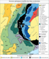
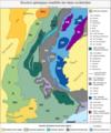
Carte des domaines structuraux des Alpes occidentales - Orelle.png 5,000 × 6,000; 2 MB
-
Carte des domaines structuraux des Alpes occidentales.png 5,000 × 6,000; 1.75 MB
-
Dolomites area.png 1,534 × 1,080; 196 KB
-
Dolomites areas.png 1,080 × 800; 1.01 MB
-
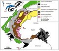
Dora-Maira-Massiv.png 595 × 518; 76 KB
-
Draugletscher.png 233 × 221; 134 KB
-
External crystalline massifs of the Alps.png 1,533 × 1,155; 154 KB
-
Ferdinand Löwls geolog. Karte vom Großglockner mit Ergänzungen (Bearbeitung).png 1,524 × 1,110; 238 KB
-
Formation Alps illustration.png 676 × 648; 82 KB
-
France geological map-fr.svg 1,636 × 1,753; 3.27 MB
-
Geological map germany 1869 equirect.png 1,823 × 2,132; 7.22 MB
-
Geological map germany 1869.jpg 1,823 × 2,132; 921 KB
-
Geologische Karte des Engadiner Fensters.png 1,809 × 1,130; 354 KB
-
Geologische Karte des Gargellenfensters.png 4,000 × 2,714; 654 KB
-
Geologische Karte des Tauernfensters.png 3,628 × 2,566; 1.9 MB
-
Geologische Schausammlung 1.jpg 2,910 × 4,458; 7.22 MB
-
Gliederung der Varisziden in Mitteleuropa.jpg 1,910 × 1,290; 510 KB
-
Italia Interazione placche tettoniche.JPG 548 × 530; 240 KB
-
Map of Alpine Glaciations.png 1,026 × 657; 1.43 MB
-
Montblanc-Massiv.png 4,137 × 3,417; 3.73 MB
-
Nw europe grav plot 2.png 742 × 841; 880 KB
-
Pennidico-ita.png 801 × 1,258; 62 KB
-
Schema tettonico delle Alpi.jpg 1,250 × 833; 532 KB
-
Schéma des 2 marges continentales des alpes.png 705 × 454; 127 KB
-
Tectonic map Mediterranean DE.svg 1,280 × 715; 622 KB
-
Tectonic map Mediterranean EN.svg 1,280 × 715; 623 KB
-
Tectonic map Mediterranean es.svg 1,280 × 715; 756 KB
-
Tectonic map Mediterranean FR.svg 1,280 × 715; 620 KB
-
Tectonic map Mediterranean He.jpg 1,324 × 770; 218 KB
-
Tectonic map Mediterranean IT.svg 1,280 × 715; 491 KB
-
Tectonic map Mediterranean MK.svg 1,280 × 715; 786 KB


%27_(11293942054).jpg/120px-176_of_%27(The_Story_of_our_Planet_..._Illustrated.)%27_(11293942054).jpg)
.jpg/120px-191_of_%27Die_Erde._Eine_allgemeine_Erd-_und_Länderkunde%2C_etc%27_(11234285016).jpg)
.jpg/75px-215_of_%27Géographie._I._La_France._Quatrième_édition%2C_entièrement_remaniée%2C_etc%27_(11224485684).jpg)


_(20424357562).jpg/120px-Bulletin_de_la_Société_belge_de_géologie%2C_de_paléontologie_et_d%27hydrologie_(1905)_(20424357562).jpg)
_(19817121303).jpg/120px-Bulletin_de_la_Société_géologique_de_France_(1896)_(19817121303).jpg)
_(20251411709).jpg/61px-Bulletin_de_la_Société_géologique_de_France_(1896)_(20251411709).jpg)
_(20250605659).jpg/120px-Bulletin_de_la_Société_géologique_de_France_(1901)_(20250605659).jpg)
_(20411155336).jpg/120px-Bulletin_de_la_Société_géologique_de_France_(1903)_(20411155336).jpg)


.png/120px-Ferdinand_Löwls_geolog._Karte_vom_Großglockner_mit_Ergänzungen_(Bearbeitung).png)


._Traduit_de_l%27allemand%2C_avec_l%27autorisation_de_l%27auteur_et_annotée_sous_la_direction_de_Emm._de_Margerie._Avec_une_préf._par_Marcel_Bertrand_(1897)_(14591532518).jpg/120px-thumbnail.jpg)
._Traduit_de_l%27allemand%2C_avec_l%27autorisation_de_l%27auteur_et_annotée_sous_la_direction_de_Emm._de_Margerie._Avec_une_préf._par_Marcel_Bertrand_(1897)_(14591597979).jpg/120px-thumbnail.jpg)


